Eti Osa is one of the fastest developing areas in Lagos, with continuous expansion across Lekki, Ajah, and surrounding high value corridors. For developers, engineers, and property owners operating in this region, accurate and timely site data is critical.
At Kings Geo Consult, we provide professional drone mapping services in Eti Osa to help clients plan, monitor, and execute projects with confidence.
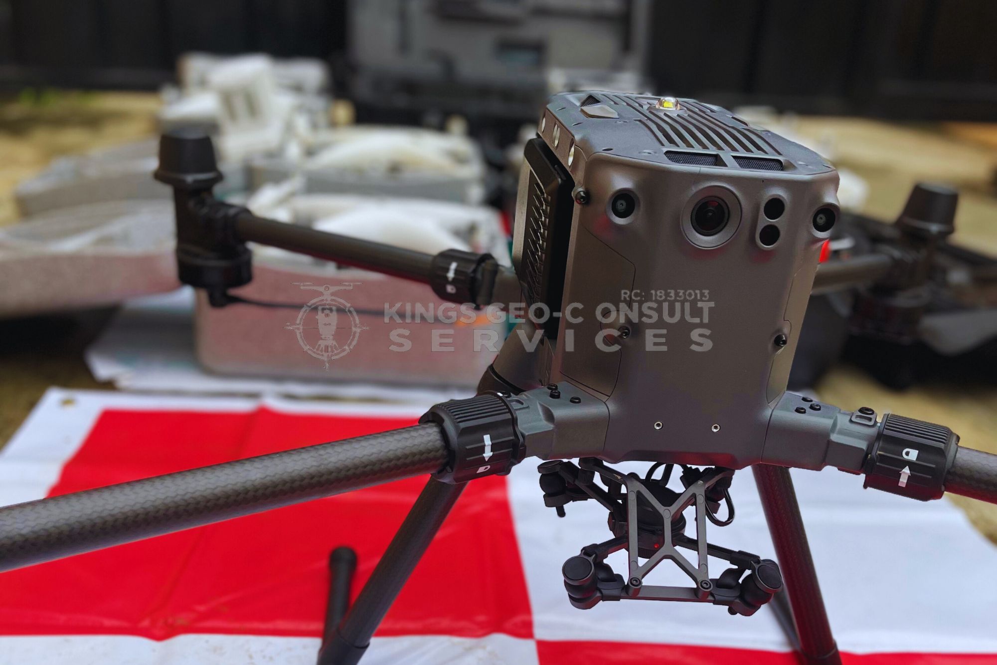
Our aerial mapping solutions deliver high resolution data that supports smarter decisions across real estate and construction projects.

Why Drone Mapping Is Essential in Eti Osa
Eti Osa presents unique development challenges. Large estates, waterfront properties, and rapidly changing landscapes require a better way to capture and analyze land information.
Drone mapping provides a complete aerial view of project sites, allowing stakeholders to understand terrain, layout, and progress without delays.
For projects in Lekki, Ajah, and surrounding areas, drone mapping improves efficiency and reduces uncertainty.
Our Drone Mapping Services in Eti Osa
We provide tailored drone mapping services designed for real project conditions in Eti Osa.
- Aerial mapping for estate development and planning
- Construction progress monitoring and documentation
- High resolution orthomosaic mapping
- Terrain and elevation analysis
- Site inspection and visual reporting
- Mapping support for infrastructure and layout design
Each project is handled using professional UAV systems and processed to deliver accurate and usable outputs.
Who Needs Drone Mapping in Eti Osa
Our services are ideal for:
Real estate developers working on estates and residential projects
Construction companies managing building sites
Engineers and planners requiring site data
Landowners with large or complex properties
Infrastructure and utility project teams
Drone mapping provides clarity that supports faster and more confident decision making.
Benefits of Drone Mapping for Projects in Eti Osa
Drone mapping offers several advantages for projects in this region.
Faster data capture across large sites
Improved accuracy compared to manual observation
Better visualization for planning and presentations
Reduced need for repeated site visits
Early identification of site issues
These benefits translate into time savings, cost efficiency, and improved project outcomes.
Local Experience That Matters
Working in Eti Osa requires an understanding of its terrain, development patterns, and project demands. From high end residential estates to commercial developments, each project presents unique requirements.
Kings Geo Consult combines drone mapping technology with practical surveying experience to deliver reliable results across Eti Osa.

Integrated With Professional Surveying
Drone mapping is most effective when combined with strong surveying expertise. Our team ensures that aerial data aligns with ground measurements and project requirements.
This integration provides clients with accurate and dependable information that can be used for planning, design, and execution.
Why Choose Kings Geo Consult in Eti Osa
Clients choose Kings Geo Consult because we deliver:
Professional UAV mapping backed by surveying knowledge
High resolution and accurate outputs
Clear and usable reports
Experience across real estate and construction projects
Reliable turnaround times
Our focus is to provide data that supports real decisions, not just visuals.
Serving Eti Osa and Surrounding Areas
We provide drone mapping services across Eti Osa including Lekki, Ajah, and surrounding high growth areas.
Whether your project is residential, commercial, or infrastructural, our team is available to support your mapping needs.
Book a Drone Mapping Service in Eti Osa
If you need accurate aerial mapping for your project in Eti Osa, our team is ready to assist.
Call now to discuss your project
Schedule a site inspection with our drone mapping professionals